Understanding the mechanisms tow trucks use to locate vehicles is crucial for business owners, especially those in sectors dependent on vehicle transport and logistics. With an increasing number of vehicles on the road, effective coordination and technology have become central to the towing industry’s efficiency. This article explores two vital components involved in locating your car: GPS technology that pinpoints exact locations and emergency services coordination that streamlines communication between drivers and towing companies. Together, these elements create a seamless experience for both vehicle owners and towing services, ensuring timely interventions.
Finding a Car on the Road: The Real Role of GPS, Dispatch, and Owner Data in Tow Truck Operations
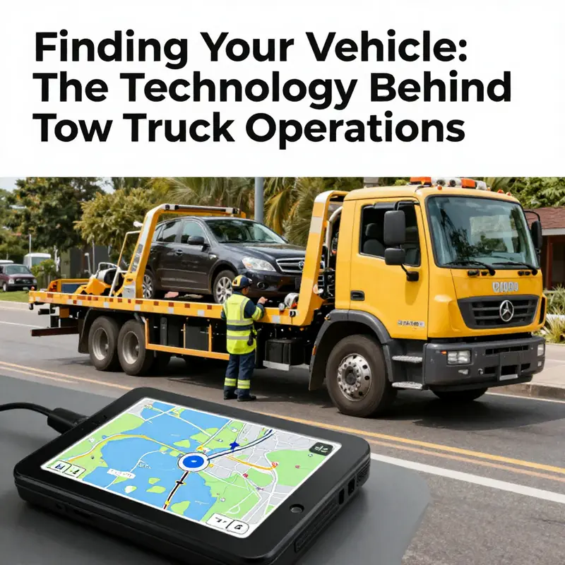
When a vehicle stalls on a crowded street, sits illegally in a lot, or disappears after being towed, the process of actually locating it is less a single moment of beacon-signal magic and more a choreography of information sharing, official coordination, and practical on-scene navigation. Tow trucks do not simply press a button and have a car appear. Instead, locating a vehicle hinges on how the incident moves from a caller to a dispatch center, and then from that center to a driver who can reach the scene efficiently. In practice, the dispatch ecosystem blends human input with digital tools, and the role of GPS is nuanced. It can accelerate or refine the search, but it is not the default method by which everyday tow operations find a car. The landscape includes emergency services coordination, the owner or authorized party’s data, and the evolving reach of vehicle telematics and automated plate systems that law enforcement or parking authorities may deploy. Together, these elements determine how quickly a tow team can pull up, assess the situation, and begin the removal or enforcement process.
The starting point, almost always, is a call. A motorist, a passenger, a roadside assistant, or a parking official contacts a towing or roadside provider. The information captured in that first exchange matters a lot: the exact location, the surrounding landmarks, the parking spot number if applicable, the license plate, and any notes about the vehicle’s condition. Dispatch operators, who act as the hub between field technicians and the requestor, rely on a centralized system that can coordinate multiple tasks at once. They log the report, verify the vehicle’s identifier, and issue a work order. In many cases, they can relay a precise geographic fix if the caller is in a city with integrated dispatch and location sharing from mobile devices. The climate of this information flow changes depending on whether the vehicle is on a road shoulder, inside a garage lot, or legally parked in a restricted zone. The more precise the initial details, the faster the tow operator can prepare the correct equipment, assign the right crew, and navigate to the location without delay.
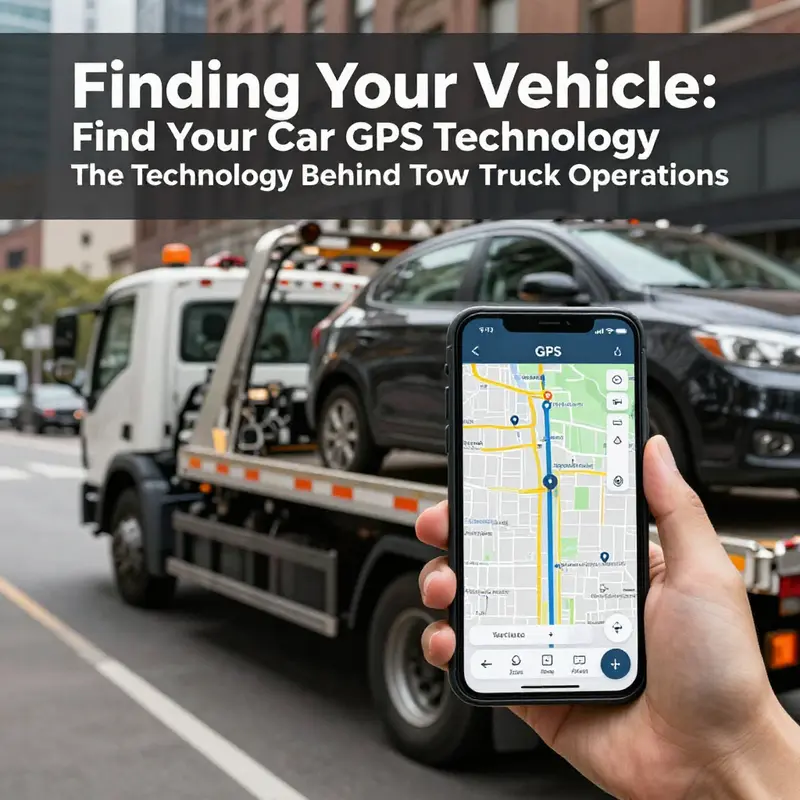
GPS enters the scene as an optional layer of accuracy. If the vehicle itself carries built-in telematics, or if the caller’s phone can share location data with the dispatcher, real-time coordinates can be provided. The advantage is clear: the driver can be guided to a moving or fixed point with fewer detours, and the navigation can account for live traffic, road closures, or other impediments. But in routine breakdowns or ordinary tows, the operator rarely relies on GPS alone to locate the vehicle. The core workflow still depends on the information supplied by the person who reported the incident and on the instruction set that the dispatcher transmits to the on-site crew. Real-time location data, when it is available, is a valuable supplement—not a replacement—for on-the-ground verification and scene assessment.
In many urban settings, law enforcement and parking enforcement add another layer of precision through automated license plate recognition. ALPR, when deployed, helps identify vehicles that are abandoned, flagged for violations, or involved in incidents, and it can trigger a notification to the responsible towing operator. This technology is not a universal trigger for all tows, and it is typically used as part of a broader investigative or regulatory process. The tow operator still benefits from the information gathered by the caller and the dispatcher. When a car has been moved or is out of its original location, the ALPR data can aid in matching a vehicle to the case file, but it does not substitute for the on-scene verification that occurs when the tow truck arrives. In short, ALPR helps locate or confirm a car in special circumstances, but the everyday act of locating a vehicle still hinges on the dispatch notes and the location data provided up the chain.
For vehicle owners who have installed telematics or place reliance on a connected services system, real-time location data can sometimes be shared with the dispatcher or the towing company, again with proper authorization. In the event of illegal towing, theft, or a chase-like scenario, these location feeds become a means to confirm the car’s whereabouts, support evidence gathering, and facilitate a prompt retrieval. The owner may request location data through a portal or app, and law enforcement can access this information if required by procedure. Importantly, the use of telematics in this context is subject to privacy protections and legal processes. It is not a casual, universal tool for every tow scenario, but when invoked correctly, it can dramatically shorten the time between the initial report and the vehicle’s recovery.
The practical journey from dispatch to roadway is also shaped by navigation behavior. Once the call is green-lit, the driver often relies on road-aware navigation software to chart the fastest route, taking into account current traffic patterns, closures, and detours. The driver’s seat is the final control point where map data meets real-world conditions: a blocked lane, a missing sign, or a one-way street that requires a different approach. The result is a dynamic drive to the scene, not a pre-scripted march to a fixed coordinate. In this sense, GPS serves as a precision tool that complements the driver’s experience and the dispatch’s instructions. It helps the crew tailor the arrival time, estimate the right duration for the tow, and reduce overall exposure to risk in congested zones.
The orchestration behind the scenes matters to anyone who has ever faced an unexpected breakdown or a dispute about a parking tow. If you are trying to coordinate a tow in a specific area, you may benefit from engaging a local service that understands the terrain, the common choke points, and the typical response times. In Washington, DC, for instance, the process can hinge on a regional coordination network that blends on-site verification with digital dispatch. A local provider winging a fast response can be a practical choice when time is critical and the scene is precarious. To see how a local operator might approach such a situation, you can explore the Washington, DC tow-truck service, which emphasizes rapid deployment and careful on-site assessment. Washington, DC tow-truck service.
Even with all these systems, the human element remains central. The person reporting the incident supplies the core cues about location and vehicle identity. The dispatcher negotiates the case with the tow operator, clarifying what kind of vehicle is needed, where to meet, and which access points or parking areas apply. The driver uses on-board notes and the live data stream to verify the scene upon arrival. When everything aligns—the report, the data, and the on-site observation—the tow process proceeds with the minimum friction possible. The result is not a single technological fix but a composite practice: a dispatch chain, optional GPS feed, regulatory support when ALPR is involved, and the driver’s navigational judgment.
For readers seeking a deeper dive into how telematics can influence location data, external resources explain how these systems can enable real-time tracking and location requests under lawful conditions. More information is available from telematics providers and related services, including resources that describe how location data can be accessed by authorized parties. https://www.onstar.com. In practice, this means that if a vehicle’s owner has enabled location sharing through a built-in telematics system, and if the proper legal pathways are followed, location data can help resolve disputes or accelerate recovery after a tow. Yet for everyday tows, GPS is not the sole driver of the locate-and-tow process. It is one of several tools that, when combined with clear communication, careful verification, and lawful data sharing, helps ensure a vehicle is found and brought in safely and efficiently.
Tracing the Dispatch Trail: How Tow Trucks Reach Your Car Through Emergency Services Coordination
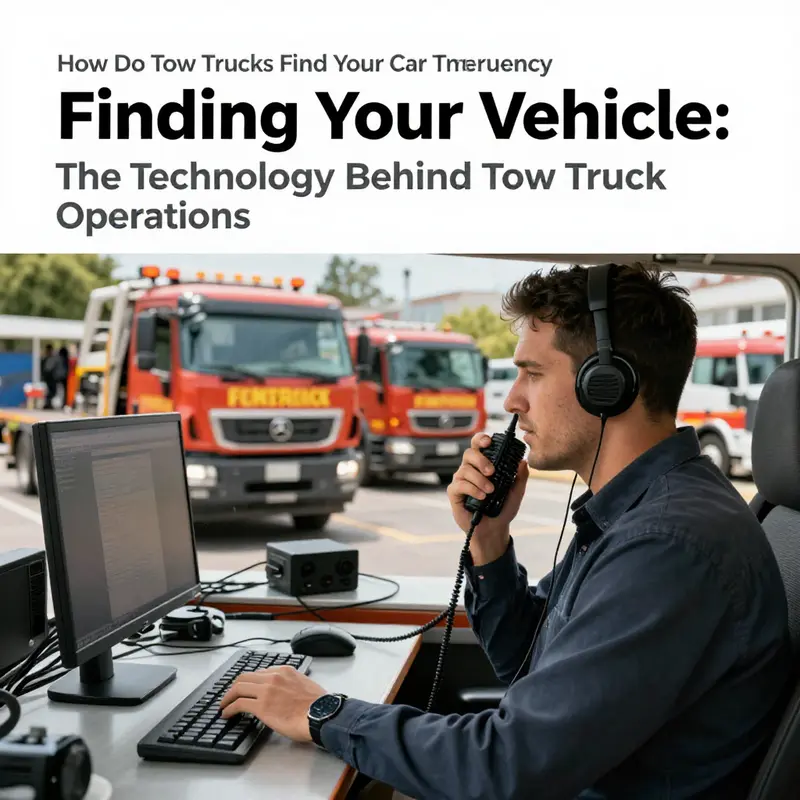
When a vehicle breaks down, or a car is parked where it shouldn’t be, the journey of a tow truck begins not with a chance glance along a highway, but with a deliberate relay. The scene is a web of emergency responders, roadside assistance networks, dispatch centers, and the drivers who ferry a car from the spot it’s stuck to safety or a shop. It looks seamless from the outside, but the choreography rests on accurate information, rapid data sharing, and precise routing. There is no lone tow truck roaming to locate a car at random. Instead, a location is handed off, refined, and acted upon in a carefully timed sequence that hinges on technology and human judgment working in concert.
The chain starts the moment someone requests help. You might call emergency services directly after a breakdown, or you might reach a roadside assistance line through your insurer or a general service program. In either case, the operator collects a clear report: where you are, what’s happening, and the kind of help you need. The location you provide is more than a street name; it becomes a data point that travels through multiple systems. Modern dispatch tools can pull location data from the caller’s phone via GPS, or from a vehicle’s embedded telematics if a car is equipped with such a system. Even if the signal from a phone wobbles, the pickup data can be triangulated or refined by the telematics feed, the dispatcher’s manual input, or a combination of both. The result is a moving target converted into a map pin that identifies the nearest capable tow unit.
In practice, the dispatch process uses a few different streams of information. Real-time GPS from the caller’s device, the vehicle’s onboard data, and sometimes environmental inputs such as time of day, traffic, and known road restrictions all feed into a central system. The software then weighs which tow truck is closest, which has the right equipment for the job, and which is available now. If a flatbed is required for an upright car, or if a wheel-lift is sufficient, the system prioritizes equipment accordingly. The goal is not simply to reach you quickly, but to reach you with a vehicle that can perform the recovery safely and without causing further damage to your car.
Beyond the digital fingerprints of a specific call, some cities deploy automated plate recognition in certain situations. When a vehicle is abandoned, towed for a violation, or involved in an incident, ALPR can flag the car as part of a broader enforcement or recovery workflow. This technology assists authorities and towing teams by cross-referencing the vehicle’s plate with an active case or a needed tow. It is not a random scavenger hunt; it is a targeted dispatch that aligns with legal or safety objectives. The human element remains integral, however. Once the tow truck arrives, the driver must confirm your identity and the specifics of the situation before proceeding. A quick check-in at the scene—confirming the location, the vehicle’s status, and the requested assistance—ensures both parties agree on the plan before lifting or winching begins.
From the moment you speak to a dispatcher to the moment the tow bed curls toward your car, navigation tools come into play. Dispatch systems are designed to connect with map and routing apps that provide the latest traffic conditions, road closures, and optimal routes. This is not a static journey; it’s a dynamic route that adapts to real-world conditions, detours, and incidents that could slow progress. The result is a smoother arrival than a traveler might expect when navigating unfamiliar streets at odd hours. In dense urban environments, the dispatcher may even coordinate with local road management to secure the fastest lane or the best approach for a tight curb. For readers in metropolitan areas seeking a nearby service, a locally appropriate option is often recommended—an example being a dedicated towing service in a given city that emphasizes rapid response and professional coordination within the local road network. If you’re curious about a region-specific option, you can explore a representative example of a towing service in Washington DC, which illustrates how urban dispatch nuances shape the response. towing service in Washington DC.
All of this hinges on data accuracy. If your location is incorrectly reported, or if the address on file is outdated, it can delay the arrival. Dispatchers work with what is given and, when possible, will ask clarifying questions to confirm directions or landmarks. They may request nearby cross streets, notable intersections, or a landmark that makes the scene easier to locate from the street. In rural areas, GPS coordinates might be more reliable than a street address, because a single road can be named differently across maps or residents’ recollections. The more precise the shared information, the faster the closest, most appropriate tow unit can be assigned and sent.
The arrival of the tow truck is more than a physical event; it is the fulfillment of a plan that began with your call. The driver verifies your identity and the situation on arrival, then explains what kind of recovery will occur. A curious reader might wonder how the truck knows exactly which vehicle to pick up if you have multiple cars in a driveway or on a property. In such cases, coordination with property managers, law enforcement, or the vehicle owner can be essential. A simple confirmation step—“this is the car in distress, correct?”—guards against misidentification and ensures the right vehicle is moved. The practical effect of this coordination is a service that respects safety, minimizes risk to the vehicle, and reduces friction between neighbors, vehicle owners, and responders.
Of course, no system is immune to hiccups. GPS signals can falter in high-rise canyons or dense-tree hollows; signals may be blocked inside garages or shaded by metal canopies. Address confusion, parking disputes, or confusing signage can also slow things down. A dispatcher may have to re-verify the location or dispatch an alternate unit if the original one cannot access the scene. Even with high-tech coordination, the human factors—calm communication, precise directions, and mutual trust—remain essential. This blend of machine-assisted accuracy and human judgment makes the process robust yet adaptable, capable of handling a spectrum of scenarios from a simple roadside breakdown to a more complex immobilization that requires careful handling.
If you want to dive deeper into how these networks function in real-world practice, public resources on roadside safety emphasize the importance of coordinated emergency response and the role of dispatch systems in reducing delays. Such guidance underlines the value of reporting accurate location information and of understanding that modern tow services operate within a broader safety ecosystem rather than as a solitary pursuit. In the end, the goal is clear: to deliver help where it’s needed, quickly and safely, while keeping the vehicle and its occupants out of further harm. For readers who want a practical touchpoint about accessing local services and understanding regional response, exploring local resources and pages about nearby towing services can be helpful for situational awareness and planning.
External reference for broader context: For a broader overview of how emergency responders coordinate roadside help, see the National Highway Traffic Safety Administration’s Roadside Assistance resource. NHTSA Roadside Assistance.
Final thoughts
In conclusion, understanding how tow trucks locate vehicles through advanced GPS technology and effective emergency services coordination provides valuable insight for business owners. This knowledge not only helps in choosing the right towing service but also emphasizes the industry’s commitment to efficiency and safety. By leveraging these technologies, towing companies can minimize wait times and provide reliable service, crucial for businesses that depend on vehicle management and transportation. Staying informed about these processes allows you to make better decisions when the need for towing arises.